
Freunden von diesem Artikel berichten:
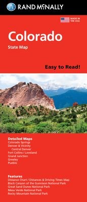
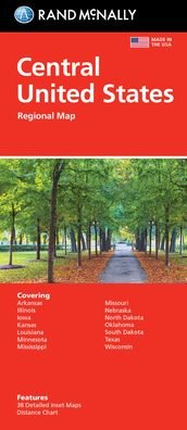
Colorado State Map
Rand McNally

Colorado State Map
Rand McNally
Rand McNally's Easy To Read State Folded Map is a must-have for anyone traveling in and around Colorado, offering unbeatable accuracy and reliability at a great price. Our trusted cartography shows all Interstate, U. S., state, and county highways, along with clearly indicated parks, points of interest, airports, county boundaries, and streets. The easy-to-use legend and detailed index make for quick and easy location of destinations. You'll see why Rand McNally folded maps have been the trusted standard for years. -Regularly updated, full-color maps. -Larger map with a bigger type size than the Rand McNally Folded Map. - Clearly labeled Interstate, U. S., state, and county highways. - Indications of parks, points of interest, airports, county boundaries, and more. - Mileage and driving times map. - Detailed index. - Convenient folded size. Coverage Area: Detailed maps of Boulder, Colorado Springs, Denver & Vicinity, Downtown Denver, Fort Collins, Greeley, Mesa Verde National Park, Pueblo, Rocky Mountain National Park.
| Medien | Bücher Gebundenes Buch (Buch mit hartem Rücken und steifem Einband) |
| Erscheinungsdatum | 6. August 2021 |
| ISBN13 | 9780528024443 |
| Verlag | Rand McNally |
| Genre | Maps & Guides |
| Maße | 500 g (Geschätztes Gewicht) |
| Sprache | Englisch |
Weitere Titel von Rand McNally


![Cover for Rand McNally · A Pocket Atlas of the [world] [cartographic Material]: Presented to the Patrons and Friends of the Chicago & North-Western Ry. Co. With the Compliments of the Passenger Department (Taschenbuch) (2021)](https://imusic.b-cdn.net/images/item/original/417/9781015179417.jpg?rand-mcnally-2021-a-pocket-atlas-of-the-world-cartographic-material-presented-to-the-patrons-and-friends-of-the-chicago-north-western-ry-co-with-the-compliments-of-the-passenger-department-taschenbuch&class=scaled&v=1649334010)


Andere haben auch gekauft
![Cover for Preben Hansen · Turen Går Til: Turen går til Californien & Vestlige USA (Taschenbuch) [5. Ausgabe] (2021)](https://imusic.b-cdn.net/images/item/original/578/9788740063578.jpg?preben-hansen-2021-turen-gaar-til-turen-gaar-til-californien-vestlige-usa-taschenbuch&class=scaled&v=1623395637)
![Cover for Anne Hjernøe · Stærk, let og mæt (Gebundesens Buch) [1. Ausgabe] (2019)](https://imusic.b-cdn.net/images/item/original/526/9788740046526.jpg?anne-hjernoee-2019-staerk-let-og-maet-gebundesens-buch&class=scaled&v=1614761186)
![Cover for Dee Brown · Bury My Heart at Wounded Knee: An Indian History of the American West (Taschenbuch) [1st edition] (2007)](https://imusic.b-cdn.net/images/item/original/843/9780805086843.jpg?dee-brown-2007-bury-my-heart-at-wounded-knee-an-indian-history-of-the-american-west-taschenbuch&class=scaled&v=1410186719)


Alle Titel von Rand McNally ansehen ( u. a. Taschenbuch , Landkarten , Gebundenes Buch , Buch und Spiralbuch )